Partial GPS tracks here
Leaving Sisters
The gravel turns red
The route ran through a section of burned forest...
... and downed trees. Ugh, hike-a-bike
Mt. Washington through the burn
Clear Lake- it's actually that blue
Lava country
Crazy ass bug
McKenzie River- one of many crossings like this
Sahalie Falls
One of many technical lava sections
Look closely on the right, there is a hot springs cave
Another view from Clear Lake
This section was so cool. Just follow an old trail, nothing packed down and obvious, all old growth trees, lots of lava and nobody in sight
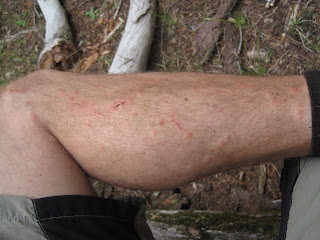
Shot taken of bug chomped leg the night before the mosquitoes got bad
High country mountain flowers
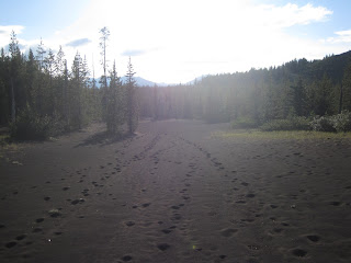
Moonscape- volcanic debris from extinct volcano Sand Mountain
Last night campsite near Sand Mt
Old fire lookout tower on top of Sand Mt
Looking south from Sand Mt looking at Mt Washington and the Three Sisters Mts
Looking north at Three Fingered Jack and Mt Jefferson
Looking west, you can see the McKenzie river valley
Good old Karate Monkey!


Nice! Looks like you had considerably less snow than us AND got to ride the Mckenzie trails! Why didn't you stay up on Sand Mtn? Didn't realize there was a lookout up there!
ReplyDeleteLooks to be a Salmon Fly. Grab one and throw it onto the river surface where you think there may be some Trout. Many times a fish will surface and snatch the bug with a big rolling splash.
ReplyDeleteBrian E
Could you do the Sisters to Fish Lake route in a day?I am planning to do this route this summer and trying to figure how much time to reserve. Would I have to bikepack it? I have mapped out all the historic segments on USGS maps from 1929. It looks like a fantastic route.
ReplyDelete