Thursday, December 29, 2011

Map Slut

Despite better technology with Google Earth/Maps and having a sweet GPS system on your bike, there is nothing quite as good as real map when you're out there, wondering which road is which. We have a BLM office here in downtown Portland. As you can see, I went there today. 2012 is going to be awesome.


Monday, December 26, 2011

Fat biking in Pacific City, Oregon

Day 1- Christmas eve

It's 53 and sunny at the beach, we have 2 1/2 hours before sunset and 3 hours before low tide. We head south from Pacific City towards the Nestucca river and Bob Straub state park.


At Bob Straub park, the grassy dunes made for some technical, fun riding.


This was all filled with water just 30 minutes ago.


This is the Nestucca river emptying into the Pacific. It's loaded with sea lions and their heads pop in and out of the water like the game Bonk the Weasel.


Regarding the video quality, it's just hand held point-n-shoot camera footage taken while riding no-handed.


Heading back north, my camera battery died, so the rest were taken with the phone. Still, it was next to impossible to take a crappy photo.


Day 2- Christmas Day

After a great dinner and beers at Pelican Brewery last night, we woke up to rain and some wicked coastal winds. The tide chart said it was 3 hours until high tide, which meant we had a small window of opportunity to head north, up and over the majestic Cape Kiwanda, then to the river where Sand Lake flows into the Pacific. I really wanted to see what the water crossing was like, whether it was an easy float with a packraft or even swim-able in the summer at low tide.

OK, so imagine heading north with a 30-40 MPH tailwind. I normally pedal between 8-12 MPH on the beach, but the wind pushed me between 10-12 MPH without pedaling for stretches as long as a mile. It was so windy, I was actually concerned about the sand blasting at Penny's eyeballs. But we proceeded anyway.


Up and over the inland side of Cape Kiwanda, it felt like another planet. The sand had a slight dirt mix, it was wet and slightly packed, and the wind blew sand over the feathered, rippled surface. If the sand was any drier and there wasn't the massive tailwind, pedaling up this would be next to impossible.


On top of the Cape, we were greeted with a rolling downhill to several miles of beach. As you can see in the distant rock outcropping, the shrinking beach was already closing the gaps.


Looking back at where we just stood, you can see how steep and roll-y the dune is. I zig-zagged down on the Pug like I was snowboarding some powder. Perhaps the most incredible feeling I've ever had on a fat bike!


One more distant shot of the Cape Kiwanda dune. Look close, that is the Pug on the left side, partially up the dune.


We rolled northbound with the wind. As the waves came up, the sea foam scattered and blew over the sand at 20 MPH.


Due to the high tides creeping up, the steepness of the cliffs and the closing gaps around some rocks, I decided to head back before making it to Sand Lake. I went from 12 MPH barely pedaling with the tailwind to a very difficult 6 MPH against the headwind.


After a mandatory zig-zag hike-a-bike up the Cape Kiwanda dune, it was time to roll down the moonscape back into Pacific City.


Day 1 GPS Profile here

Day 2 GPS Profile here

OREGON. GET SOME!!

Monday, December 19, 2011

Fat biking in Neskowin, Oregon

We get these strange weather patterns in Oregon where it's cloudy and wet in Portland, but warm and sunny on the coast. The tourist season is over, the hotels have cheap rates and the beaches are practically vacant.


Proposal Rock in Neskowin. Sunny and 55!


The next day was wet and mild. We headed north towards the Nestucca river, but were cut off just short due to high tides around this rock outcropping. No big deal, it was a great spot to drink my morning coffee.


Saturday, October 29, 2011

It's fat bike season

Sandy River, shallow water, late October, sunny day. It's officially fatbike season.


Friday, September 9, 2011

Late summer- packrafting and gravel riding

The Deschutes river lets out into the mighty Columbia river 65 miles east of Portland. Instead of the lush green forests many people know about Oregon, this is dry country, with rolling yellow hills, grazing cattle and small old towns named Dufur, Wamic and Moro.

From our campsite along the Deschutes, Donnie and I hiked 3 miles upstream with packrafts. It was quite hot and very dry. As we hiked, we also scoped out sections of the river that might give us trouble. We were a couple of river rookies after all.

There was one section with supposed class-3 rapids. As we stared at it from shore above, we both agreed to stay left as we approached. Turns out, it was a piece of cake, but something that could've easily flipped your head onto a 3 foot boulder.


No helmets, little experience and two cans of confidence named Coors. Hell yeah. It was hot, so getting in the water felt really good. Moving at a leisurely 3 MPH is something I can get into.


The next day, I set off for a dirt ride in the surrounding hills. A large group of riders also camping were off for a 125-mile deathmarch ride called the Oregon Stampede. With expected 100 degree heat, I was looking at riding just 50-70 miles at my own pace.

Riding up, out of the Columbia river gorge


Look close,Mt.Hood is barely visible through the smoke from all the forest fires happening at the time.


There wasn't much scenery, so I took photos of the dried out barns and farm houses.


Just pretend it's really hot on this road and you'll know what the day consisted of.


More barns


This abandoned farm house caught my eye. It was cool and creepy. Despite the No Trespassing sign, I had to check it out.


Look at all the bird crap and broken floorboards. It smelled like animal. The half door hinges were predictably creaky. One careful step at a time, I looked up to notice the lack of plaster on the ceiling. It had completely fallen in and showed to underside of the roof.


Just before I stepped into the living room/dinish room/main room, I noticed a several stacks of hay. WTF? A pile of hay.

Sudden movement- A CAT!?!. Oh wait, it's just a barn cat. Well, I had my camera ready and just caught it jumping out the window. Creepy cat. What's next?


The cat set me up for the next sight, a dead coyote. What would an abandoned farm house be without bird shit, creaky doors, a barn cat and a dead coyote?


Really, who would move out of here with a view like this?


Onward down the road, I could see deer sitting in the shade all over the place. But these stooges were a little more active. Have you ever seen a deer really trying to accelerate across pavement? Their hooves slip, kind of like Scooby Doo's legs at the sight of the 10,000 volt ghost.


Another old building to check out. Surprisingly, the schoolhouse looked like it was still used during the school year. I walked in, wiped the spider webs off my face and proceeded to read the chalkboard. Jenny and Mike 4-ever. Twizted thoughts. Violent J for president. I just had to join the club and write on the chalkboard that I was there.


I rode 60 miles total and got back to camp in time for another 3-mile hike and float on the Deschutes. Not a bad weekend.

Float GPS profile here

Ride GPS profile found here

Monday, August 29, 2011

Banks to Gearhart- in 12 hours

Clatsop county is the northern-most county in Oregon along the Pacific ocean. It's packed with thick pine forests, some old growth areas, the mighty Columbia river and some of the most stunning beaches on Earth. Despite these things and the close proximity to Portland, there is relatively little information for traveling by bike, off-road, through the area.

Enter Topographic software. I'd plotted a route from Portland to Gearhart that was around 110 miles with half of it being gravel. The gravel portion of these routes is always tricky because many of the roads out here are built for logging. The general rule I use is: for every road on your map, there are actually 6 roads built by the logging industry that don't show up on your map. But when a harvested tree area is replanted and allowed to grow for 40 years, Mother Nature also reclaims the roads, so some roads may no longer exist.


Banks-Vernonia re-decked rail bridge


To be honest, I didn't think my legs or body could ride the expected 9+ hours, so I took the free bus from Portland to Banks to cut off 27 miles of getting through the suburbs. The only downside with the bus is that I didn't arrive in Banks until almost noon, limiting the sunlight to about 8 hours, so I brought minimalist lights to finish the ride in the dark.

Banks is the starting point for a 21-mile rails-to-trails section. To some, rail trails are super boring. But I find them a good alternative to anything with cars on it. The Banks-Vernonia was packed with blackberries and mostly shaded, so it was a nice way to start the ride.


So good!

You never know what you're going to crave when you get to the Sentry Market in Vernonia.


From Vernonia, I rode Keasey Road for 7 miles of pavement before finding my first section of gravel road was incredibly grown over. Skipped that, and rerouted to the next section, which was a nice gravel road... for a while.


End of Keasy Road meant the end of pavement


It's common to encounter the road taking a dive like this, through a creek and thick brush...


... and sometimes you get through that section with rewards like this...


...and this.


Old-growth trees stumps are like natural tombstones


OK, so here is a good example of why I preach the benefits of riding FAT tires. Photos have a way of smoothing out the terrain. I rode 700x35mm tires today, and wished I had 700x42 or fatter. Why? See below.


This photo is taken with my bike in the exact same position as above, only at the ground level to show the rocks. Sure, it was rideable with 35mm tires, but it beat the crap out of me and slowed me down. Smaller tires often equate to more work!


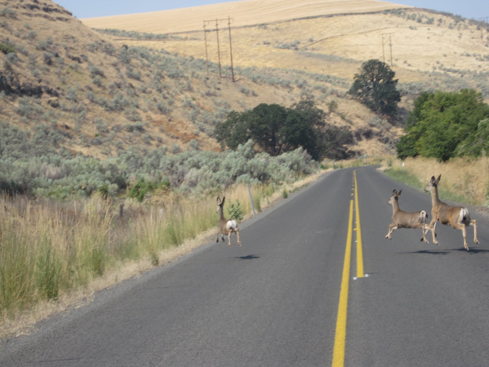
My favorite shot of the day. I'm not going to confirm this is Saddle Mountain in the background, since I was so lost, but it's at least close to Saddle Mountain.


The next 30-some miles of gravel would prove difficult, as there were three more roads that either didn't exist, or were too grown over to ride or push a bike through. There were so many re-routes that my maps weren't zoomed out far enough to provide me with more alternatives.


This particular "road" got narrower and more wild. One of four incorrect sections on the day.


Look closely, you can barely see my bike. This road was taken over by trees, then completely dropped off into a stream, and did not continue on the other side. Nice. Reroute once again.


It was 7:30 p.m. and the sun was going down. When I zoomed out on my GPS to see how far I was from Gearhart, I was only 2/3 of the way there. At this rate, even in the daylight, it would probably take me 4 hours. But without daylight, there would be no way to use the natural reference points, like Saddle Mountain, to find my way.

For about 5 minutes, I contemplated sleeping in the woods. I had a jacket that I would stuff with dried grass for insulation, and I'd build a soft bed area with the same grass. My food supply and water tablets were good, so I knew I wouldn't suffer too badly, even when it drops into the low 50's (F) for the night. But without cell phone reception and not wanting to have the search party sent for me, the only choice was to get off the gravel and onto the highway.


The clock was ticking to find pavement.


Highway 202 is part of a fantastic route from Portland to Astoria. While I knew my plan B was taking pavement to Gearhart, I hadn't really mapped it out. The Hood-to-Coast running relay was the only thing happening on the Hwy. 202, so I knew there would be help if I needed it.

Shortly after I popped onto 202, it was pretty much completely dark, and I realized I was at the base of the largest climb over the coast range. 8+ hours into the ride, and I get to climb a huge ass hill.

My initial fears of whether my body could make it or not went away, as the climb seemed easy. My legs were still working well, there was almost no traffic and the stars were getting really bright. Believe it or not, I felt like I finally was starting to have a good ride.

Once down the other side of the hill, an hour onto 202, I ran into an aid station for the Hood-to-Coast running relay. I finally had cell phone reception and called my wife to say I was an hour away. I also ran into a nice lady selling biscuits and gravy for the runners. I ordered 2 servings , even though I could've eaten 6. She saw the fatigue in my face and offered up a sleeping bag for the night. Once again, I contemplated sleeping in a foreign place until sunrise. Nope, had to keep riding.


Yeah, I know it doesn't look appetizing right now. But this was the best damned overpriced out-of-a-can biscuits and gravy I've ever tasted.


The rest of the ride was fairly flat for being in the coast range. As I neared Astoria, I was realizing how far I out of the way I had to ride to get to the Oregon Coastal Highway. When I told my wife it'd be an hour, I didn't realize it would be 4.

But again, there was little to no traffic, the stars were out, my legs were still going and it was fun as hell. I finally rolled into the town of Gearhart and hit McMennamin's Sandtrap Bar at 11:55 pm, just 5 minutes before the grill closed down. Ordered a big burger with fried egg and bacon, with a raspberry stout on nitro to wash it down. Wow, that was a tasty burger.


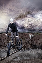
Finally made it to Gearhart and stopped for a self portrait.


I'd ridden a pretty solid 12 hours, with only stopping for food breaks and semi-frequent map/GPS breaks. There was enough time during my ride to go through a whole range of emotions: from pissed to angry, from elated and to ecstatic, and from lost to more lost, I finally found myself on the beach, with my wife, my dog and my two good friends. I love Oregon!

Ride profile here