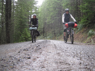
It's officially dirt touring season here in Oregon. The snow has melted below 3,000 feet and the gravel logging roads are open to the coast. With the stellar Velodirt Rapture ride happening this weekend, we opted to load up and take the long way from Portland to the Rapture start/finish at Flying M Ranch.
Avenging my first taste of bikepacking in the Tillamook forest from two years ago, I really wanted to complete the route from Gales Creek to Browns Camp, this time actually knowing where I was going. With better mapping skills and a GPS with routes plotted in advance, I was surely not going to get lost. Or at least, not as lost as last time.
Day 1- Portland to Horse Camp
Cheever and I loaded up and rolled to the lightrail station Friday morning. The lightrail ride is a fantastic way to get you through the stupid suburbs. From Hillsboro, we pedaled 15 miles to Gales Creek Tavern, which marked the end of pavement for the next 60+ miles and a welcomed lunch spot. The part that sucked was the tavern was closed. Or perhaps this was a blessing, as we surely would've installed several beers into our legs before the huge hike up into the coast range.
Tavern closed = trail mix for lunch
First signs of gravel and slugs on Old Wilson Road
I warned Cheever about pushing our bikes, and within a few miles of the tavern, that's exactly what we were doing. Bikepacking isn't glamorous or fast, but you get to experience the outdoors in places where all the race nerds never go. It's easy to stop and look around, or lay down and have a sip of whiskey along the way.
Fuzzy caterpillar
From here along Old Wilson road, we rode and walked our bikes up several miles, took a few dead end roads, tried hike-a-biking through some clear cut debris, and finally gave in to following the power lines towards Browns Camp
Much trickier on a loaded 60-pound bike.Once we got to this spot, I knew where we were. Scoggins road was a quick 2-mile ride on the relatively easy gravel road, and it would take us directly to Browns Camp
Some rolly dirt mounds looked deliberately placed here to keep trucks off this road
University Falls road
Whack-a-Mole
We had passed Browns Camp and University Falls, were feeling fatigued and started looking for a camping spot. In my mind, I wanted to go a bit further. But we came upon a ridge and saw some wet weather coming our way. We opted to check out this horse camp as a potential home for the night.
Time for dry sausage, whiskey...
...and the slingshot
It took us about 45 minutes, but we finally got a fire started with all the damp wood. The ironic thing is- by the time we'd put all that work into making the fire and drank most of our booze stash doing so, we were pretty much warm and ready for bed. But before bed, we walked through the woods to a clearing and watched the "supermoon" shine through the quickly passing clouds. It was to be full the next night, but was already plenty bright
We started the day with a nice long gravel downhill
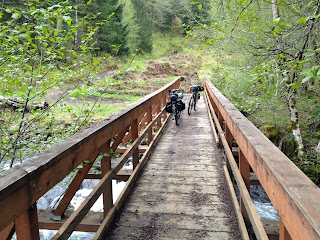
This bridge was specifically built for motos to link the vast array of OHV trails. When you're at a river, you know you have a climb ahead of you. We just didn't know it was going to be a 2,000 foot climb up C-Line and Lyda roads.
These moto trails are not very bikepacking worthy. It's hard to see how steep it is from a photo, but it's probably close to a 40% grade as far as we could see through the woods
Fortunately, we had plenty of gravel roads under 15% grade to ride up...
and up...
... until we hit several snow patches near Timbuktu. Seriously, there is a dot on the forest map to indicate Timbuktu, but I challenge anybody to find some form of establishment or past encampments.
More moto trails through the clearcut
Once we topped out around 3,000 feet, it was chilly and Williams road had been regraded with chunky gravel. 29" x 2.1" tires were the perfect medium for the whole trip
Williams road leads from Timbuktu, winds around a long ridge and eventually drops us down to North Trask River road, which is part of the Rapture course
Most of the Tillamook State forest is a tree farm. While it takes from the beauty, you have to understand that paper products come from somewhere, and these roads wouldn't exist without them. I'm just thankful the logging/paper companies who operate the land allow use of bicycles, often times on roads where other motorized traffic isn't allowed
This waterfall was about 30-40 feet tall
The goal for the day was to make it back to Flying M Ranch, where the Rapture ride was finishing up. Since we ran out of whiskey, we were motivated to get to the keg before it started floating in the ice bucket. After dropping from Williams road to N. Trask River road near Barney Reservoir, we started seeing some signs of civilization, and lycra
Our only elk spotting of the weekend, just a few miles shy of Flying M Ranch
A creepy clown pinata greeted us at Flying M Ranch. It was Cinco de Mayo, afterall. Beer, food, fire, camp, laugh, sleep
Day 3- Flying M Ranch to home
After breakfast was served at Flying M Ranch, 5 of us rolled down Railroad Grade road towards the lightrail station in Hillsboro that would take us home. One more gravel descent down Mt. Richmond road and I hit my gravel road record (on a loaded bike), 40.7 MPH.
Pit stop for fried food and Hamms
We boarded the lightrail in Hillsboro to take us into Portland. With one last stop at the historic Goose Hollow Tavern for lunch and beers, I realized how dirty I was. The socks on my feet and the shirt on my back hadn't been removed for 3 days. The satisfaction of knowing the off-road route to Browns Camp, living outside for the entire weekend, and seeing more of the Tillamook state forest was all that really mattered.


