Friday, September 9, 2011

Late summer- packrafting and gravel riding

The Deschutes river lets out into the mighty Columbia river 65 miles east of Portland. Instead of the lush green forests many people know about Oregon, this is dry country, with rolling yellow hills, grazing cattle and small old towns named Dufur, Wamic and Moro.

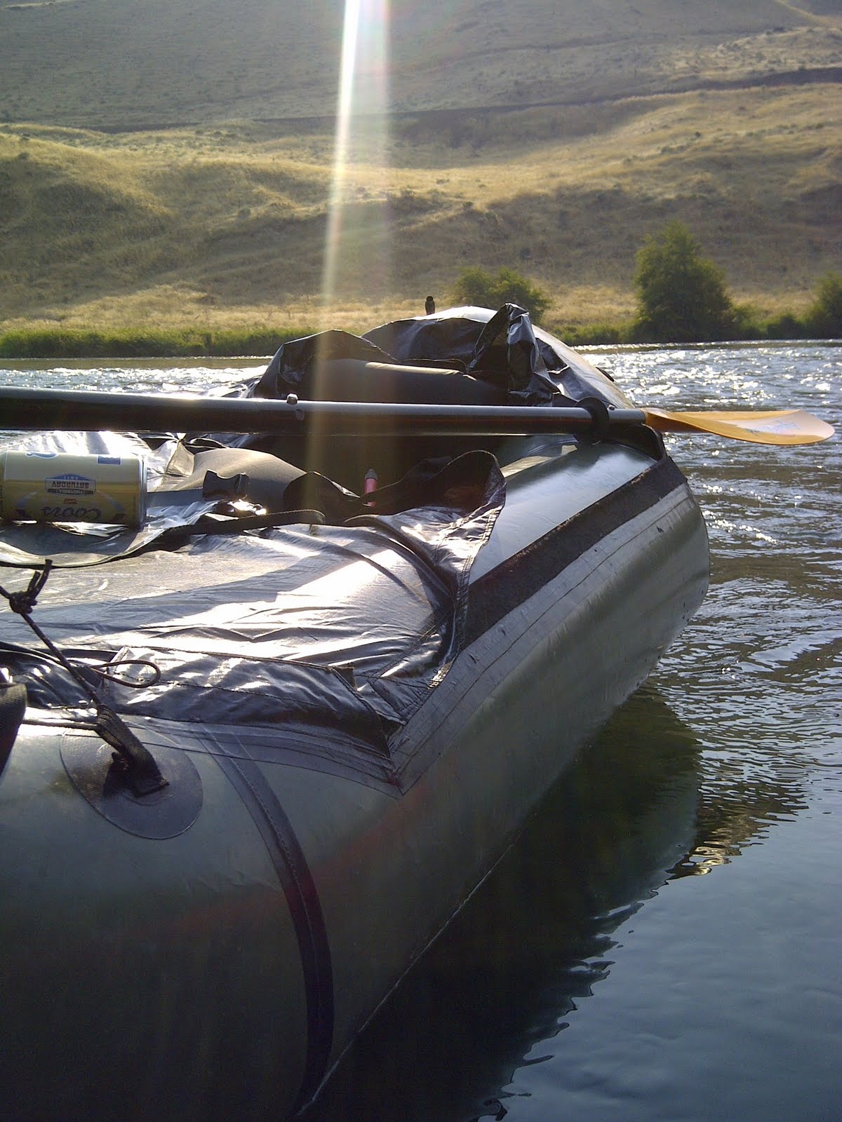
From our campsite along the Deschutes, Donnie and I hiked 3 miles upstream with packrafts. It was quite hot and very dry. As we hiked, we also scoped out sections of the river that might give us trouble. We were a couple of river rookies after all.

There was one section with supposed class-3 rapids. As we stared at it from shore above, we both agreed to stay left as we approached. Turns out, it was a piece of cake, but something that could've easily flipped your head onto a 3 foot boulder.


No helmets, little experience and two cans of confidence named Coors. Hell yeah. It was hot, so getting in the water felt really good. Moving at a leisurely 3 MPH is something I can get into.


The next day, I set off for a dirt ride in the surrounding hills. A large group of riders also camping were off for a 125-mile deathmarch ride called the Oregon Stampede. With expected 100 degree heat, I was looking at riding just 50-70 miles at my own pace.

Riding up, out of the Columbia river gorge


Look close,Mt.Hood is barely visible through the smoke from all the forest fires happening at the time.


There wasn't much scenery, so I took photos of the dried out barns and farm houses.


Just pretend it's really hot on this road and you'll know what the day consisted of.


More barns


This abandoned farm house caught my eye. It was cool and creepy. Despite the No Trespassing sign, I had to check it out.


Look at all the bird crap and broken floorboards. It smelled like animal. The half door hinges were predictably creaky. One careful step at a time, I looked up to notice the lack of plaster on the ceiling. It had completely fallen in and showed to underside of the roof.


Just before I stepped into the living room/dinish room/main room, I noticed a several stacks of hay. WTF? A pile of hay.

Sudden movement- A CAT!?!. Oh wait, it's just a barn cat. Well, I had my camera ready and just caught it jumping out the window. Creepy cat. What's next?


The cat set me up for the next sight, a dead coyote. What would an abandoned farm house be without bird shit, creaky doors, a barn cat and a dead coyote?


Really, who would move out of here with a view like this?


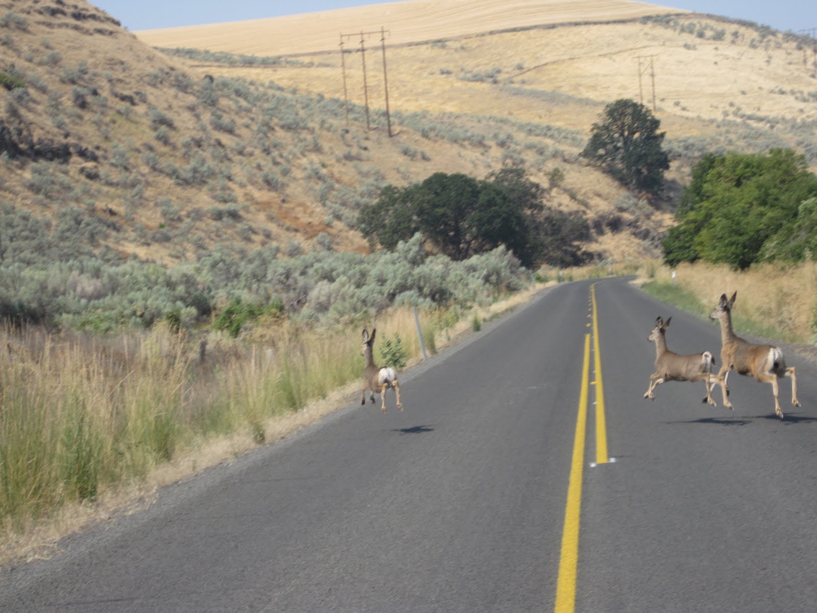
Onward down the road, I could see deer sitting in the shade all over the place. But these stooges were a little more active. Have you ever seen a deer really trying to accelerate across pavement? Their hooves slip, kind of like Scooby Doo's legs at the sight of the 10,000 volt ghost.


Another old building to check out. Surprisingly, the schoolhouse looked like it was still used during the school year. I walked in, wiped the spider webs off my face and proceeded to read the chalkboard. Jenny and Mike 4-ever. Twizted thoughts. Violent J for president. I just had to join the club and write on the chalkboard that I was there.


I rode 60 miles total and got back to camp in time for another 3-mile hike and float on the Deschutes. Not a bad weekend.

Float GPS profile here

Ride GPS profile found here

Monday, August 29, 2011

Banks to Gearhart- in 12 hours

Clatsop county is the northern-most county in Oregon along the Pacific ocean. It's packed with thick pine forests, some old growth areas, the mighty Columbia river and some of the most stunning beaches on Earth. Despite these things and the close proximity to Portland, there is relatively little information for traveling by bike, off-road, through the area.

Enter Topographic software. I'd plotted a route from Portland to Gearhart that was around 110 miles with half of it being gravel. The gravel portion of these routes is always tricky because many of the roads out here are built for logging. The general rule I use is: for every road on your map, there are actually 6 roads built by the logging industry that don't show up on your map. But when a harvested tree area is replanted and allowed to grow for 40 years, Mother Nature also reclaims the roads, so some roads may no longer exist.


Banks-Vernonia re-decked rail bridge


To be honest, I didn't think my legs or body could ride the expected 9+ hours, so I took the free bus from Portland to Banks to cut off 27 miles of getting through the suburbs. The only downside with the bus is that I didn't arrive in Banks until almost noon, limiting the sunlight to about 8 hours, so I brought minimalist lights to finish the ride in the dark.

Banks is the starting point for a 21-mile rails-to-trails section. To some, rail trails are super boring. But I find them a good alternative to anything with cars on it. The Banks-Vernonia was packed with blackberries and mostly shaded, so it was a nice way to start the ride.


So good!

You never know what you're going to crave when you get to the Sentry Market in Vernonia.


From Vernonia, I rode Keasey Road for 7 miles of pavement before finding my first section of gravel road was incredibly grown over. Skipped that, and rerouted to the next section, which was a nice gravel road... for a while.


End of Keasy Road meant the end of pavement


It's common to encounter the road taking a dive like this, through a creek and thick brush...


... and sometimes you get through that section with rewards like this...


...and this.


Old-growth trees stumps are like natural tombstones


OK, so here is a good example of why I preach the benefits of riding FAT tires. Photos have a way of smoothing out the terrain. I rode 700x35mm tires today, and wished I had 700x42 or fatter. Why? See below.


This photo is taken with my bike in the exact same position as above, only at the ground level to show the rocks. Sure, it was rideable with 35mm tires, but it beat the crap out of me and slowed me down. Smaller tires often equate to more work!


My favorite shot of the day. I'm not going to confirm this is Saddle Mountain in the background, since I was so lost, but it's at least close to Saddle Mountain.


The next 30-some miles of gravel would prove difficult, as there were three more roads that either didn't exist, or were too grown over to ride or push a bike through. There were so many re-routes that my maps weren't zoomed out far enough to provide me with more alternatives.


This particular "road" got narrower and more wild. One of four incorrect sections on the day.


Look closely, you can barely see my bike. This road was taken over by trees, then completely dropped off into a stream, and did not continue on the other side. Nice. Reroute once again.


It was 7:30 p.m. and the sun was going down. When I zoomed out on my GPS to see how far I was from Gearhart, I was only 2/3 of the way there. At this rate, even in the daylight, it would probably take me 4 hours. But without daylight, there would be no way to use the natural reference points, like Saddle Mountain, to find my way.

For about 5 minutes, I contemplated sleeping in the woods. I had a jacket that I would stuff with dried grass for insulation, and I'd build a soft bed area with the same grass. My food supply and water tablets were good, so I knew I wouldn't suffer too badly, even when it drops into the low 50's (F) for the night. But without cell phone reception and not wanting to have the search party sent for me, the only choice was to get off the gravel and onto the highway.


The clock was ticking to find pavement.


Highway 202 is part of a fantastic route from Portland to Astoria. While I knew my plan B was taking pavement to Gearhart, I hadn't really mapped it out. The Hood-to-Coast running relay was the only thing happening on the Hwy. 202, so I knew there would be help if I needed it.

Shortly after I popped onto 202, it was pretty much completely dark, and I realized I was at the base of the largest climb over the coast range. 8+ hours into the ride, and I get to climb a huge ass hill.

My initial fears of whether my body could make it or not went away, as the climb seemed easy. My legs were still working well, there was almost no traffic and the stars were getting really bright. Believe it or not, I felt like I finally was starting to have a good ride.

Once down the other side of the hill, an hour onto 202, I ran into an aid station for the Hood-to-Coast running relay. I finally had cell phone reception and called my wife to say I was an hour away. I also ran into a nice lady selling biscuits and gravy for the runners. I ordered 2 servings , even though I could've eaten 6. She saw the fatigue in my face and offered up a sleeping bag for the night. Once again, I contemplated sleeping in a foreign place until sunrise. Nope, had to keep riding.


Yeah, I know it doesn't look appetizing right now. But this was the best damned overpriced out-of-a-can biscuits and gravy I've ever tasted.


The rest of the ride was fairly flat for being in the coast range. As I neared Astoria, I was realizing how far I out of the way I had to ride to get to the Oregon Coastal Highway. When I told my wife it'd be an hour, I didn't realize it would be 4.

But again, there was little to no traffic, the stars were out, my legs were still going and it was fun as hell. I finally rolled into the town of Gearhart and hit McMennamin's Sandtrap Bar at 11:55 pm, just 5 minutes before the grill closed down. Ordered a big burger with fried egg and bacon, with a raspberry stout on nitro to wash it down. Wow, that was a tasty burger.


Finally made it to Gearhart and stopped for a self portrait.


I'd ridden a pretty solid 12 hours, with only stopping for food breaks and semi-frequent map/GPS breaks. There was enough time during my ride to go through a whole range of emotions: from pissed to angry, from elated and to ecstatic, and from lost to more lost, I finally found myself on the beach, with my wife, my dog and my two good friends. I love Oregon!

Ride profile here


Sunday, August 7, 2011

Fat bike, skinny dog, wide beach

During our last ride touring the dry Deschutes County back country, Donnie and I had been talking about riding fat bikes. Down the canal, on the beach, through the sand dunes and on the Alvord Desert.

As usual, he beat me to it last weekend. So instead of riding where he rode, I traveled one beach further north on the Pacific coast, between the towns of North Cove and Westport, Washington.

Perhaps my least practical but most fun bike, the Surly Pugsley, is the perfect beach bike. My dog, Penny, is also the perfect companion for this sort of slow, all-day, overnight adventure.

Where it begins at North Cove


It's always strange to see what washes up on the beach. There were at least a dozen wooden picture frames scattered about. This one apparently had a bit of life left in it.


20 minutes into the ride- a beer break


View looking out at the jetty


Not quite sure what this structure was all about, but I'm pretty sure it had something to do with a bag of mushrooms and some 4 Loco


This fishing boat had a cool face painted on the front. As I took the photo, a sea lion surfaced with a fish flopping out of it's mouth.


We arrived at the north end of the beach with the sun plenty high in the sky. We had already scoped out our camping spot in the bushes, so it was all relaxation until sunset. A couple big cans of beer and my flask of Bushmills was just perfect.


With camp all set up, we went back to the beach to bark at the moon


This bush camping spot was pretty sweet. Totally in the woods, a block from the beach, nobody around, and drinking water to be poached nearby. Aside from the mosquitoes, it was perfect.


Finishing up the ride on day 2, with around 32 miles for the round trip. Penny still had some zip in her stride, but was asleep within two minutes of getting back to the car for the drive home.

Sunday, July 24, 2011

Back Country Touring in Deschutes County-

We've been looking at the 5-map series of the Oregon Back Country Discovery Route for a long time, wondering when we could pull off a long trek on the dry side of the Cascade range. Sometimes you can't wait for a week off, you just have to maximize the 3-day weekend.

Thursday night- We drove 2-1/2 hours and car camped at Suttle Lake, about 15 miles from Sisters, Or. I drank way too many beers, slept in, and got a later start than expected. But it's vacation, can't feel too guilty.

Day 1- Sisters

From Suttle Lake campground, we drove into Sisters, parked the car, packed the bikes, and rolled over to Sisters Coffee Company for breakfast. Things always taste better when you're camping, but their coffee is exceptionally good.


The first 2-miles of pavement out of town was already scenic


Red dirt is typical of the dry side.


Within 8 miles, we veered off (our intended) course and into some bush whack.


Not to be deterred, we pushed through what ended up being nearly 1/2 mile of uphill hike-a-bike to the next road. Totally worth it.


We popped out on a nice road through a burned out area. I'd guess it happened 10 years ago, based on the new trees and underbrush. It made for a spectacular scene with the new green, the old dead trees and vivid blue sky.


I ended up with about 30 photos that looked exactly like this...


...and this

Stop, eat, drink, look at maps, high five, carry on


If you've read this blog before, you've heard me say mountain bikes are the only way to go for loaded off-road touring. This section is one of many we encountered that was quite rough for a 55-pound bike. Even the smooth looking road sections were rougher than the camera shows and softer than skinny 700 x 45 tires would allow. I asked Donnie if given the choice between a Pugsley and a 700x45 cross bike on these trails, he'd take the Pug. Me too.


At the end of the day, we each had less than 5 miles left in our legs. Seconds after Donnie suggested we check this little roadside campsite out, we knew it was home for the night. Wychus Creek provided fresh water, a cold bath and a lulling noise throughout the night. While sitting around the fire eating dinner, a big grey fox trotted within 100 feet of our campsite, seemingly without regard for us. It was the only real wildlife we'd encounter for the rest of the trip.


Day 2- Whychus Creek to Tumalo Creek
When you're back country bike touring, you don't always have the luxury of stopping into a town to fill up with water. You have to read your maps, look for creeks/streams, carry purification tablets/filters/Steri-Pen and make sure you have enough water in between sources. Donnie carried 3 full-sized waterbottles with a back up 250-ml dromedary bag, while I had two small bottles and 250ml dromedary bag.


Day 2 started with climbing out of the Whychus Creek valley. Just when you thought the views weren't going to get better than they were on day 1, you stop and turn around to see this. Fuck!


After just a few miles of nice gravel to start the day, we popped out on State Highway 16 where a sign said we were just 7 miles from Sisters. According to my GPS, we had traveled almost 40 miles since Sisters the day before. Just goes to show how much you can miss if traveling the path most taken.

Highway 16 turned out to be a monstrous 6-mile paved climb. Each time you thought you were nearing the top, it went up again. Finally, with gravel in sight, the road topped out near the Three Creeks Recreational area.


Always a master a good suggestions, Donnie thought to stop at a roadside creek, fill up with water, and take another swim. While sitting on the side of the road, a small truck pulled up, the driver rolled his window down and said "I'm gonna make you boys an offer you can't refuse"

Being that we'd been talking about beer for two days, I sarcastically replied "what, do you have some beer in the back of that truck?"

In fact, he pulled out two cans, and they had ice on top of them, and they weren't Coors Light (which I would've kindly taken, BTW). Nope, it was a Caldera Pale Ale. While normally a damned fine beer, this can of beer stands as the best single can of beer I've drank in 2011. Cheers, brothers, whoever you were!


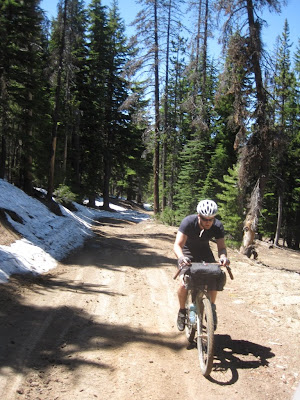


From Three Creeks and the best beer of the year, we continued to climb a bit more towards the highest point of our three-day ride, just under 7,000 feet elevation. As half-expected, we hit snow on the road


It was only a 1/4 mile, but we pushed our bikes through the snow as fast as we could so the mosquitoes didn't eat us alive.


We opted to divert from the trail to check out Tumalo Falls, and it was almost all downhill to there. Shortly after taking this picture of Donnie, I hit 40.3 mph, which is quite sketchy riding loaded bike on gravel. I've never been so happy to have the trusty Karate Monkey under me.


Yet another great high-speed straightaway


Finally to Tumalo Falls, and well worth the side trip. We ran across the race course of the High Cascade 100 MTB race, got some support from the course marshals and took a much needed 90-minute break from riding. Naturally, the break included a wash in the creek.

While leaving Tumalo Falls, we were going to ride the paved road for a bit to expedite the spot where we thought we'd camp for the night. But a local rode by as we were pumping our tires up, and gave us a stellar recommendation to go back on the road by Tumalo Creek to hit an old abandoned canal road.


Much like the kindness of the beer bearing dudes earlier in the day, his advice was exactly what we needed. A 10 minute ride of gradual gravel led us to this spot on Tumalo Creek. The canal had been built to supply water for Bend, Oregon, but the reservoir apparently didn't hold water. Nice. Made for as good of a campsite as we had the night before.


The remains of the canal diversion made for a good spot for a tent


Thanksgiving dinner! Stove Top stuffing mix, dried potato flakes, dehydrated turkey slices, dried cranberries and just-add-water turkey gravy. Quite good. Next time I'll add dehydrated corn.

Day 3- Waking up early, I made extra coffee and walked down the dried up canal, thinking how sweet this would be for a future fat bike ride.


The abandoned road along side the canal was flat and slightly downhill. With how much climbing we'd done on the trip so far, we were happy to have some flat grades to pedal on.


After the canal road, we hit some singletrack, saw some random mountain bikers, stopped at a natural freshwater spring, and got to old railroad grade road 4606 that would take us most of the way back to Sisters. 4606 was flat, slightly downhill and considerably more exposed to the sun than we had on the prior days.


Almost to Sisters, where we could finally eat the BBQ and pie we had thought about for the last 3 days


Pulled pork and a cold Hamms. Spectacular.


Marionberry cobbler. Yum.

Overall, it was the best trip of the summer. If you're planning on touring the dry side of the Cascades via dirt, I strongly recommend the following:

- A mountain bike with fat tires
- More than one series of maps
- In addition to maps, a GPS with downloaded topo maps was really handy
- Capacity to carry a bunch of water
- Go light, your body and your bike will appreciate not having to haul excessively heavy touring gear

If you want to follow our route- GPS coordinates can be found here