Day 1- Christmas eveIt's 53 and sunny at the beach, we have 2 1/2 hours before sunset and 3 hours before low tide. We head south from Pacific City towards the Nestucca river and Bob Straub state park.
At Bob Straub park, the grassy dunes made for some technical, fun riding.


This was all filled with water just 30 minutes ago.

This is the Nestucca river emptying into the Pacific. It's loaded with sea lions and their heads pop in and out of the water like the game Bonk the Weasel.

Regarding the video quality, it's just hand held point-n-shoot camera footage taken while riding no-handed.
Heading back north, my camera battery died, so the rest were taken with the phone. Still, it was next to impossible to take a crappy photo.


 Day 2- Christmas Day
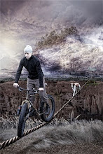
After a great dinner and beers at Pelican Brewery last night, we woke up to rain and some wicked coastal winds. The tide chart said it was 3 hours until high tide, which meant we had a small window of opportunity to head north, up and over the majestic Cape Kiwanda, then to the river where Sand Lake flows into the Pacific. I really wanted to see what the water crossing was like, whether it was an easy float with a packraft or even swim-able in the summer at low tide.
OK, so imagine heading north with a 30-40 MPH tailwind. I normally pedal between 8-12 MPH on the beach, but the wind pushed me between 10-12 MPH without pedaling for stretches as long as a mile. It was so windy, I was actually concerned about the sand blasting at Penny's eyeballs. But we proceeded anyway.
Up and over the inland side of Cape Kiwanda, it felt like another planet. The sand had a slight dirt mix, it was wet and slightly packed, and the wind blew sand over the feathered, rippled surface. If the sand was any drier and there wasn't the massive tailwind, pedaling up this would be next to impossible.

On top of the Cape, we were greeted with a rolling downhill to several miles of beach. As you can see in the distant rock outcropping, the shrinking beach was already closing the gaps.

Looking back at where we just stood, you can see how steep and roll-y the dune is. I zig-zagged down on the Pug like I was snowboarding some powder. Perhaps the most incredible feeling I've ever had on a fat bike!

One more distant shot of the Cape Kiwanda dune. Look close, that is the Pug on the left side, partially up the dune.

We rolled northbound with the wind. As the waves came up, the sea foam scattered and blew over the sand at 20 MPH.

Due to the high tides creeping up, the steepness of the cliffs and the closing gaps around some rocks, I decided to head back before making it to Sand Lake. I went from 12 MPH barely pedaling with the tailwind to a very difficult 6 MPH against the headwind.
After a mandatory zig-zag hike-a-bike up the Cape Kiwanda dune, it was time to roll down the moonscape back into Pacific City.
 Day 1 GPS Profile hereDay 2 GPS Profile here
OREGON. GET SOME!!


